Crab Season in Maryland runs from April 1to to December 15th.
Catch me if you can !!!
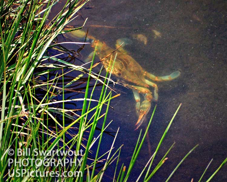
Chesapeake Bay Blue Crab lurking in a marsh at Assateague Island, Maryland.
Prints available: CLICK HERE

U.S. Pictures – Bill Swartwout Photography
United States Seascapes, Landscapes and More…
Chesapeake Bay Blue Crab lurking in a marsh at Assateague Island, Maryland.
Prints available: CLICK HERE
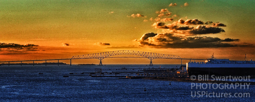
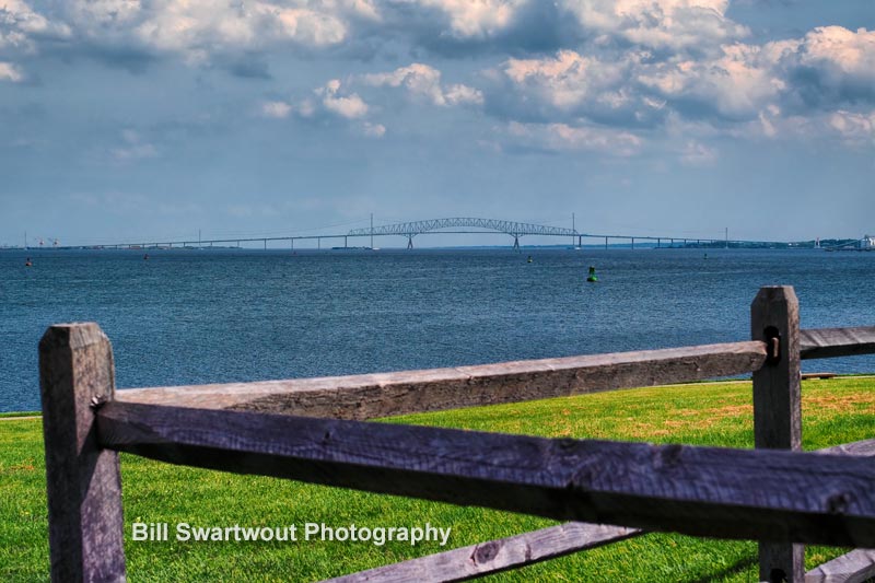
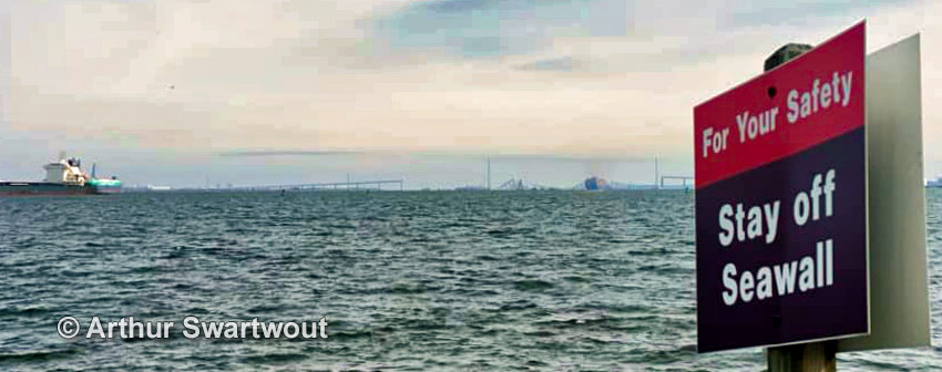
A tragic ship collision caused the Key Bridge to collapse like a house of cards on March 26, 2024.
In the wee hours of a cold March morning, a large freighter, the Dali, lost power and steerage control and collided with a major support of the Francis Scott Key Bridge in Baltimore, Maryland. The collision occurred at 1:28 AM and caused the main supporting structure to fail and the bridge spans to, literally, fall apart.
Imagine the chaos that ensued when a massive freighter collided with the Francis Scott Key Bridge, causing sections to collapse into the Patapsco River below. The sheer force of impact from the container ship left onlookers stunned and authorities scrambling to respond to this unprecedented disaster. As emergency crews rushed to the scene, questions arose about how such a catastrophe could have occurred in one of the busiest waterways in Maryland. This disaster effectively closed the (very busy) Port of Baltimore for an indeterminant length of time.
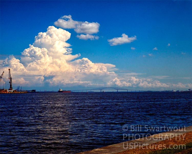
The Key Bridge was opened for use in 1977. This author can remember watching the construction process for the years before the opening. The full name is, of course, derived from the lawyer, Francis Scott Key, who penned the words to our National Anthem, the Star Spangled Banner.
The collapse of the Francis Scott Key Bridge in Baltimore sent shockwaves through the city as the iconic structure crumbled into the Patapsco River. The aftermath of the bridge collapse revealed a startling vulnerability in our infrastructure and raised concerns about the safety of maritime navigation through this vital transportation corridor at the state and national levels. Investigations underway and repair efforts are already being planned. One can’t help but wonder about the long-term implications of this incident on shipping traffic and regional economy. As we await updates on this developing story, it’s clear that lessons must be learned from this tragic event to prevent similar disasters in the future.
For many, this catastrophic event raised questions about infrastructure resilience and safety in a rapidly changing world. In moments like these, we are reminded that even our most trusted landmarks are vulnerable to unexpected challenges and that vigilance and care must be paramount in safeguarding our communities from potential disaster.

Visit www.FSKBridge.com for more photos of the Key Bridge as it used to be.
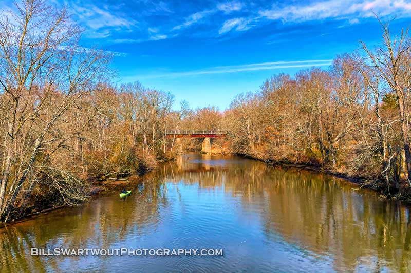
Over the river and through the woods to grandmother’s house we go in a make-believe train at the Tuckahoe State Park. The bridge has been out of service for many, many years but still stands over the Tuckahoe River along Route 404 in the center of the Delmarva Peninsula, the Eastern Shore of Maryland.
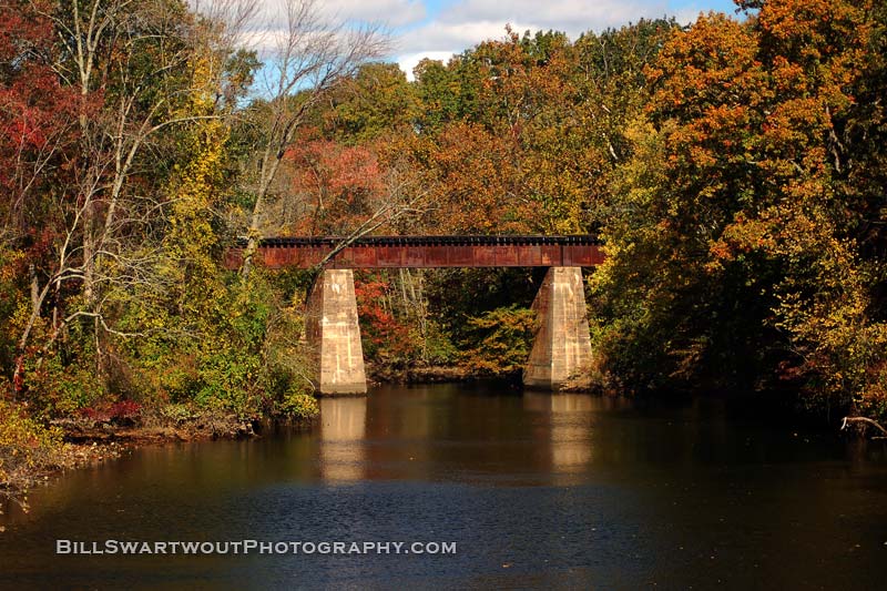
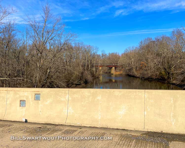
The Tuckahoe River Railroad Bridge in Queen Anne, MD is a beautiful and important landmark that has been part of the community for over 100 years. Located near the intersection of Route 404 and Route 50, this bridge is an integral part of the local history. Built in 1909, the Tuckahoe River Railroad Bridge stands as a testament to the engineering genius of its creators. Tucked away in the woods and now partially overgrown, this bridge is quite hard to find. It was originally built by the Pennsylvania Railroad and is a one-lane concrete and steel structure that spans the Tuckahoe River. Its overall length is over 100 feet and it stands 26 feet tall. The bridge is located at the southern border of the Tuckahoe River State Park and is “briefly” visible to vehicles passing by on Maryland Route 404 near Queen Anne, Maryland.
“Tuckahoe State Park is a public recreation area located along Tuckahoe Creek in Caroline and Queen Anne’s counties on the Eastern Shore of Maryland, United States. Adkins Arboretum, a garden and preserve maintaining over 600 native plant species, occupies 500 acres of the park.” (from :Wikipedia)
The above photograph was taken in 2014 and has been a popular image of Bill Swartwout Photography’s online gallery. So, of course prints are available along with a variety of home decor items.
Link to: Tuckahoe River Railroad Bridge in the Fall
Link to: other images of the Tuckahoe River Bridge
Link to: Bill Swartwout Photography Gallery.
Link to: Railroad Bridge at Tuckahoe State Park (below)
Built in 1858, the Fenwick Island Lighthouse stands as a beacon of history for the small towns of Fenwick Island, Delaware and Ocean City, Maryland.
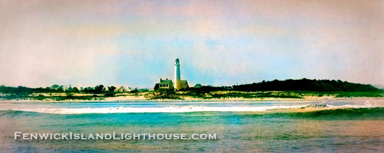
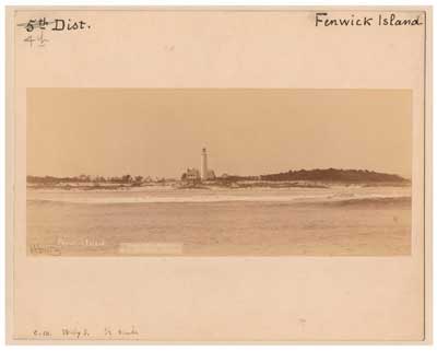
Looking way back, this panorama photograph of the Fenwick Island Lighthouse in coastal Delaware was created and colorized from an 1891 faded black and white image downloaded from the United States National Archive website.
The Fenwick Island Lighthouse Station has been aiding navigation for mariners since August 1, 1859. Today, the historic structure is a popular tourist destination, especially for photography enthusiasts. The “Fenwick Light” is an historic landmark located in southernmost Delaware right at the border with Ocean City, Maryland.
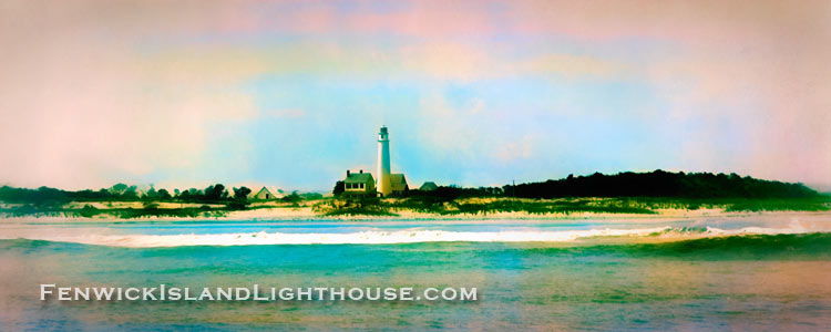
A quote from the website: “The official opening of the Fenwick Island Lighthouse, when the light was first lit as an aid to navigation, was on August 1, 1859.” That makes the Fenwick Island Light the oldest lighthouse in Delaware.
Visit a website about: The Fenwick Island Lighthouse
Link to: The Panorama Photograph
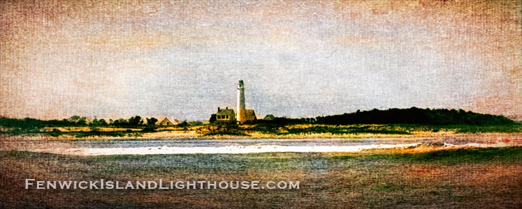
Link to: The Abstract Panorama Image
Link to: The Simulated Canvas Painting of the Lighthouse
Link to: Fenwick Island Lighthouse Wall Art Collection
This beach scene in Ocean City, Maryland is a bit extraordinary because of the numerous rock jetties that have been exposed by a recent massive coastal storm. The wave action and green water of the Atlantic Ocean is enhanced by the exposed rocks and cliff-like shape of some areas of the beach.
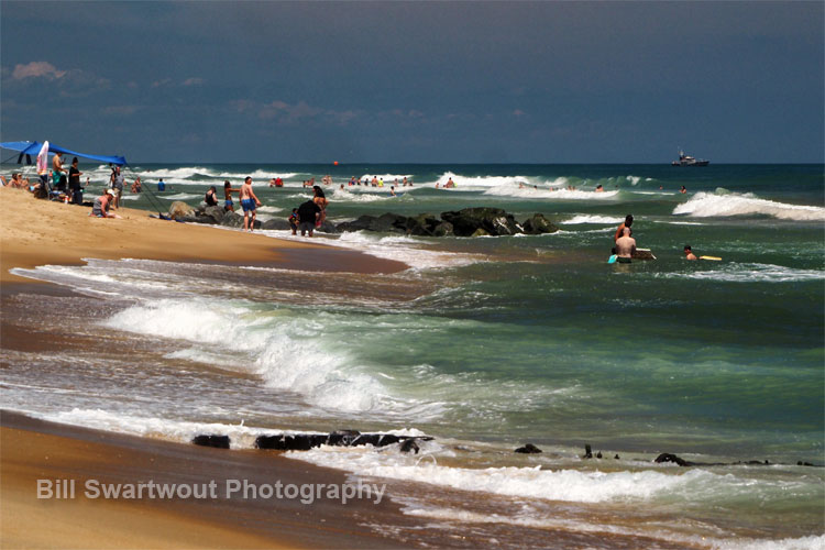
This area of the Ocean City beach, about mid-boardwalk in the 12th Street to 15th Street area never has rocks and or jetties exposed the way these are seen. The storm repositioned hundreds of thousand tons of sand, exposing some areas and filling in some other areas. But, not to fear, time and wave action will eventually restore the beach to what we are more used to seeing.
There is a Coast Guard Cutter lying at anchor just offshore. It is not there to protect swimmers from the occasional rip currents, the lifeguards are fully capable of that, but is there to assist with the Ocean City Air Show taking place the weekend this photograph was captured.
This has been an enormously popular beach scene of the Ocean City, Maryland surf. When it was originally shared on social media it received hundreds of engagements, comments and shares. It is an actual photograph that appears a bit “painterly” because of the colors and the lighting. One seldom sees the beach, sand and waves in OCMD quite like this.
Photographs on a variety of substrates and also on home decor items are available at the links below. Click to shop…
Link: Ocean City Beach Rocks, Waves and Sand
Link to: Bill’s Ocean City Collection.
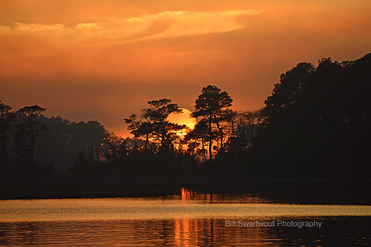
The setting sun disappears into the trees at the western edge of Assawoman Bay at The Point of the Live Bayside Community. This golden sunset is in southern Delaware to the west of Ocean City, Maryland, and Fenwick Island, Delaware.
As the sun sets, atmospheric factors begin to play a much larger role in determining what features of the sunset we can see. Where we are in relationship to the horizon will greatly affect how much of the sun will be visible above the horizon. The same can be said for atmospheric conditions. If a sunset has a lot of clouds and haze, less of the sun will be visible. If it’s perfectly clear, this will allow more of the sun to shine through and illuminate additional parts of the sky. In essence, all sunsets are different because every atmospheric condition is different, but there are certain tendencies which we can observe as consistent patterns.
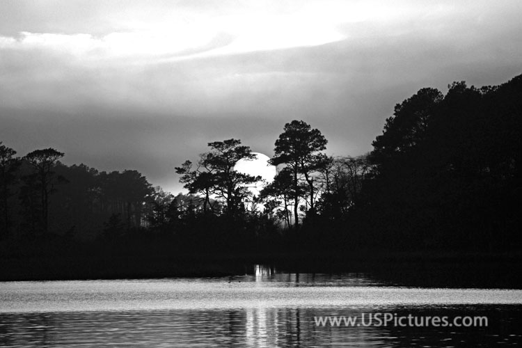
A black and white presentation of a gorgeous orange-sky sunset may lack the color but the monochrome emphasized the shading a detail of the trees. B&W also “works” in a more modern decor environment and even in a business office.
Click the links for more information and to browse or shop the variety of wall art and decor items available.
Link: Sun Setting in Trees
Link: Sun Setting in Trees in Black and White
Link to: Bill’s Fine Art America Gallery
Link to: Bill’s Pictorem Ocean City Gallery (w/ Free Shipping)
I have been to this exact location on several different occasions over the years and I have never seen a sunset from this vantage point that can quite match this one.
Sometimes it’s hard to believe that so many sunsets can look so different. But if you’ve ever watched one in the same spot over several days, you get to see all of the different ways the sun can set on a warm summer evening or at the end of a frigid wintry day. This golden sunset is in southern Delaware to the west of Ocean City, Maryland, and Fenwick Island, Delaware.
This is probably my favorite sunset. It couldn’t have been any more perfect. The sun prints the water perfectly while the clouds are there to add some drama to the sky. This shot reminds me of being on vacation and seeing these gorgeous sunsets day after day. I hope you enjoyed this beautiful example of one of nature’s splendor!
How Downtown Baltimore looked nearly two decades ago.
This Baltimore Inner Harbor photograph is one of the most popular, as being one of the first images to be sold multiple times over the nearly 20 years since the Baltimore City skyline looked this way. What differences could you see today – if you were to trek to the top of Federal Hill Park in South Baltimore to view this vista in person?
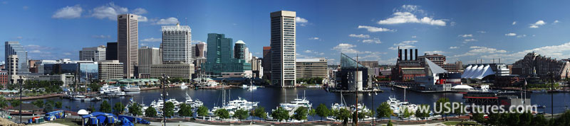
The same image is also available in a black and white presentation. This view emphasized the lines and shape of the city skyline as opposed to making an overall statement in color. A lot can be said for black and white images in a contemporary setting, such as a modern home or an office. Especially an office in one of the buildings in this nearly two decade old photograph
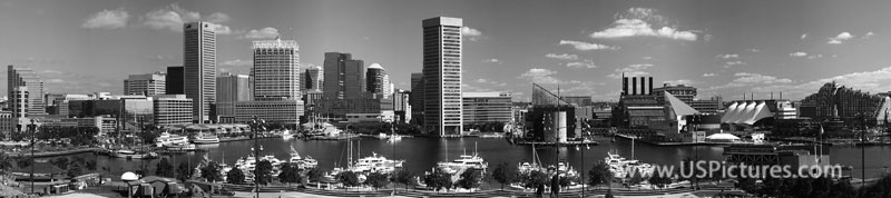
This image has appeared in countless conference pamphlets over the years, it is in print in a book on Urban Geography by the Harvard University Press and was even used by the City of Baltimore at a “sister cities” conference in The Netherlands.
Links to larger images and to browse or buy.
Link: Baltimore Inner Harbor Panorama Photograph
Link: Baltimore Inner Harbor Panorama in Black and White
Link to: Baltimore Collection at Fine Art America
Link to: Baltimore Collection at Pictorem (w/ Free Shipping)
Notes: The decade-old photograph of the famous Baltimore Inner Harbor is a compilation of four images “stitched” together, yet is still relevant today. There are some differences over the last dozen or so years. Can you spot them? Imagine the differences from the time Fort McHenry defended Baltimore during the War of 1812. Imagine how this city might appear if the British Invasion was not thwarted.
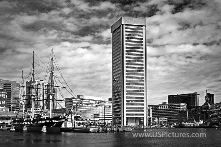
Photographs of an iconic skyscraper and an historical ship in the Baltimore Inner Harbor.
Baltimore’s World Trade Center on Pratt Street in downtown Baltimore stands tall above the historic USS Constellation, the only surviving ship from the Civil War era, in the famous Inner Harbor.
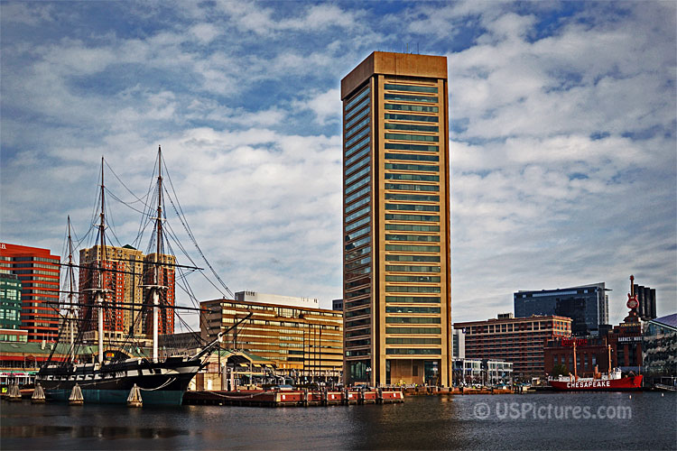
This photograph of two of Baltimore’s best-known landmarks is also available in a black and white presentation.
Here is where to see larger images and browse wall art and home decor items.
Link: Baltimore World Trade Center and Constellation
Link: Baltimore World Trade Center and USS Constellation Monochrome
Link to: The Baltimore and the Inner Harbor Wall Art Collection.
The Baltimore World Trade Center stands tall above the historic Constellation in the Baltimore Inner Harbor. It offers stunning views of the harbor, downtown Baltimore and beyond.
What do you see? In this image, the Baltimore World Trade Center stands tall above the historic USS Constellation. The Baltimore’s WTC stands 400 feet above this Maryland city’s waterfront promenade.
At the top of the Baltimore World Trade Center is an observation deck. While you’re there, you might want to check out the nearby USS Constellation, a former Navy ship that later became a museum and attraction in Baltimore’s Inner Harbor. Both are excellent photo opportunities–the former for a picture-perfect view of Baltimore and the latter because it’s way cool.
You’ve been burning the midnight oil but now it’s time to take a break. After grabbing a quick snack, you decide to take the elevator up to the observation deck of Baltimore’s World Trade Center. Wow, what a view! It almost seems like you are floating above the city in some kind of tall ship. Below you can see the historic Constellation and the Domino Sugars sign off in the distance. Across the water, on the south shore, you can see the tall and grassy Federal Hill Park that overlooks the Inner Harbor. You head back down to your hotel room (office, apartment) and smile as you notice everyone seems to be smiling as well.
The World Trade Center, designed by architectural firm Pei Cobb Freed & Partners, is the crown jewel of Baltimore’s Inner Harbor. The juxtaposition between this contemporary building and the adjacent historic buildings—including the National Aquarium—adds to its grandeur. The World Trade Center was featured in the 2014 movie The Fault in Our Stars.
The Baltimore World Trade Center and USS Constellation wall art is a must-have piece of Baltimore memorabilia. Our photo print is available as a ready to hang poster, a photo blanket, a travel mug and more.
Dramatic and graceful, the wonderful work of architecture is one of Baltimore’s most beloved landmarks. Its unique spherical observation deck is located a third of the way up the building, with windows that offer extraordinary views of the harbor, city, and surrounding areas.
Link: Baltimore World Trade Center and Constellation
Link: Baltimore World Trade Center and USS Constellation Monochrome
Link to: The Baltimore and the Inner Harbor Wall Art Collection.
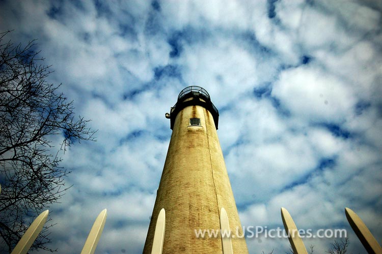
The Fenwick Light is located on the state line border between Delaware and Maryland. It is just inside the town of Fenwick Island, Delaware and just across the line from Ocean City, Maryland. The Fenwick Island Lighthouse was first lit on November 10, 1808.
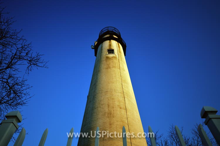
An early morning clear blue sky provides a fine backdrop for this first “looking upward” view of the Fenwick Island Lighthouse.
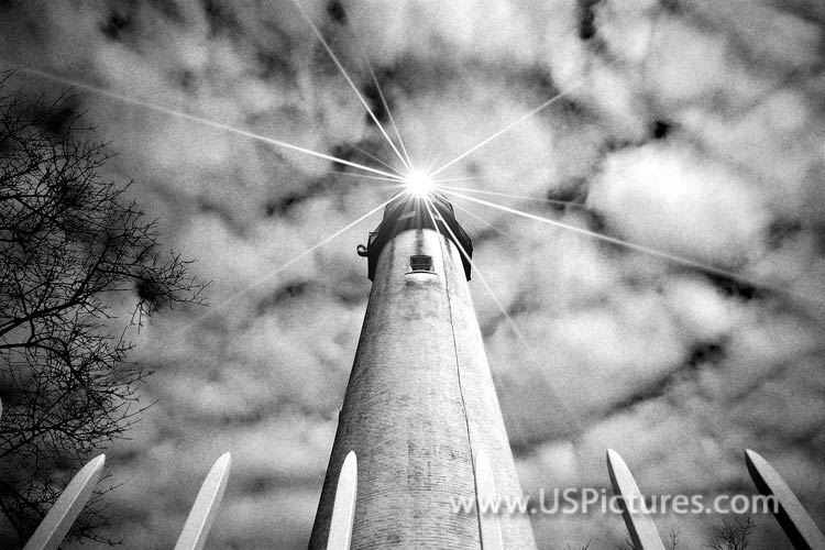
An unusual Mackerel Sky frames this wide angle shot of the Fenwick Island Lighthouse just north of the state line between Maryland and Delaware.
An unusual Mackerel Sky, in a black and white presentation, frames this wide angle shot of the Fenwick Island Light with an added “star filter” for emphasis on the light. The images above are also available in B&W without the additional edit.
Links to: the Fenwick Island Lighthouse in my Fine Art America/Pixels Gallery.
Links to: the Fenwick Island Lighthouse Lens at Pictorem.
The above are but a few sample of my photographs of the Fenwick Island Light. I love to showcase and preserve the unique beauty in and around my Coastal Delaware home. This lighthouse landscape photography is just one of a wide variety of memorable photographic opportunities that make online galleries unique.
Fenwick Island is located on the state border of Delaware and Maryland, and there are a few places along the boardwalk where you can get right up to the line. I was lucky enough to be in this place at sunset when the light was all aglow. This photograph is one of a series that I took during my trip recently.
Whoa! It’s a bird, it’s a plane–it’s a photograph of the Fenwick Light. You can bring this state line landmark into your home with the help of these high quality art photographs.
I’ve have the pleasure of photographing the Fenwick Island Lighthouse at various times. These photographs come in many sizes, and will look great wherever you place them.
Delaware. The Fenwick Island Lighthouse Preservation Society will keep this light at its current location. A prime spot for photographing the summer sunsets of Ocean City, Maryland and the summer sunrise of Rehoboth Beach,
Fenwick Island Light, also known as Fenwick Island Lighthouse, is located just inside the limits of the town of Fenwick, in the state of Delaware. When it was built in 1866, it was one of the first 50 lighthouses to be established by the federal government. It is a conical, rubble stone light and is a height of 128 feet.
Fenwick Island Light is one of the few remaining lighthouses in Delaware, and is located within the vacation destination of Fenwick Island. It’s location enabled it to serve as a navigation beacon for mariners sailing along the Delaware and Maryland coasts.
In the early 19th century, mariners from colonial Delaware and Maryland operated a series of beacons to protect them from sandbars and other hazards along their coastlines. Today, one of these lighthouses still shines over Fenwick Island.
I’m a photographer. That’s my job. My passion is photography and my favorite thing to do is shoot coastal and coast-related images. There’s something very calming and peaceful about being near the ocean beach. I am a skilled photo guy who likes to travel and make photographs of places I’ve been. I don’t set out to produce amazing art. If I do, then that’s just a bonus.
This is where I live. It’s nice here, but you have to watch out for the flying fish. (That joke isn’t even funny… it’s just inside Delaware.)
Looking for a fun way to brighten up your office? Need a gift idea that’s both quirky and useful? These trendy, affordable wall art prints will provide both. Perfect for children’s rooms, too! (copy.ai)
Another of my older photographs dates back to January 31, 2014 and a winter cruise to warm Caribbean islands and sunshine. The frozen waters beneath the Chesapeake Bay Bridge reflect the waning light of the last sunset on the last day of January, 2014. We do not see an icy Chesapeake Bay like this very often and this particular combination of lighting and ice floes in the Bay may never be seen again.
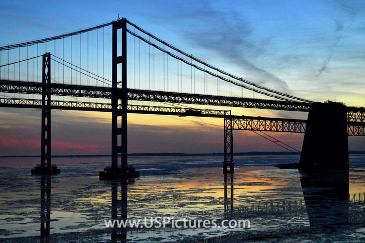
Officially, the William Preston Lane, Jr. Memorial Bridge, this dual structure spans over four miles of the Chesapeake Bay connecting Maryland’s Western Shore to Kent Island and the Maryland Eastern Shore on the Delmarva Peninsula. Standing 186 feet high at the highest point, this bridge instills fear in the hearts of many drivers who cross it. However, most drivers and passengers simply revel in the beauty of this engineering marvel.
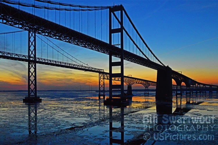
The above are two slightly different views of this rare occurrence of seeing ice floes as far south as the Chesapeake Bay Bridge. The orange light of the setting sun adds to the dramatic impact of this scene and is likely something that will not be photographed again. Yes, it was cold on the top deck of the Grandeur of the Seas when I shot these photographs but certainly not as cold as being in the water.
Link to gallery at FAA/Pixels: Chesapeake Collection
Link to gallery at Pictorem: Chesapeake Bridges (Free Shipping)